
Understanding Drone Laser Scanners
The advent of drone technology has revolutionized the way industries approach surveying and mapping. Among the most impactful innovations is the drone laser scanner, which integrates powerful laser scanning capabilities into unmanned aerial vehicles. This technology allows for the rapid and precise capture of spatial data, making it a valuable tool in various fields such as construction, forestry, and environmental monitoring. In this guide, we will explore the intricacies of drone laser scanners, their benefits, and how to effectively implement them in your operations.
What is a Drone Laser Scanner?
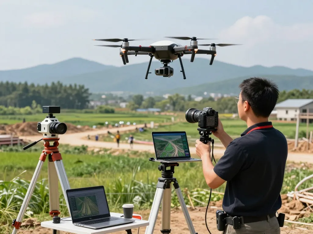
A drone laser scanner is a type of unmanned aerial vehicle (UAV) that is equipped with laser technology, specifically LiDAR (Light Detection and Ranging), to collect detailed three-dimensional data from the Earth’s surface. Unlike traditional surveying methods, which require extensive human labor and time, drone laser scanners can quickly capture large areas and provide high-resolution point clouds that represent the scanned environment. This data is essential for creating accurate maps and models which can be used in numerous applications from civil engineering to agriculture.
Key Components and Technology Behind Drone Laser Scanners
The effectiveness of a drone laser scanner is rooted in its sophisticated components and technology. Key elements include:
- LiDAR Sensors: These are the core of the scanning technology, emitting laser pulses to measure distances and generate 3D models.
- GPS and IMU: Global Positioning System (GPS) and Inertial Measurement Units (IMU) ensure accurate positioning and orientation of the drone, which is crucial for precise data collection.
- Camera Systems: Many drones are equipped with high-resolution cameras that can capture visual data, which can be integrated with LiDAR data for enhanced analysis.
Applications Across Various Industries Using Drone Laser Scanners
Drone laser scanners have found applications in a wide range of industries, reflecting their versatility and effectiveness:
- Construction: Used for site surveys, volume calculations, and quality control, improving project management efficiency.
- Agriculture: Helping farmers monitor crop health and manage resources through detailed topographical data.
- Environmental Monitoring: Facilitating the assessment of natural resources and land changes over time.
- Mining: Assisting in mine planning, volumetric calculations, and safety inspections.
Benefits of Drone Laser Scanners
Major Advantages Over Traditional Surveying Methods
Drone laser scanners offer significant advantages over traditional surveying techniques, mainly due to their ability to cover large areas quickly and safely. Here are some of the key benefits:
- Speed: Drone surveys can be completed in a fraction of the time it takes to conduct traditional ground surveys.
- Safety: Drones can access hazardous or hard-to-reach areas without putting surveyors at risk.
- Detail: They produce high-resolution data that provides better accuracy in modeling and analysis.
Cost-Effectiveness and Time Efficiency of Drone Laser Scanning
Investing in drone laser scanning technology often results in significant cost savings for businesses. The reduction in labor costs and the acceleration of project timelines contribute to a rapid return on investment. Additionally, by minimizing the time spent on the field, companies can allocate resources to other critical tasks, thus enhancing overall productivity.
Improved Data Accuracy and Quality in Mapping Projects
The precision of the data collected by drone laser scanners far surpasses that of traditional methods. This enhanced accuracy is essential for industries that rely on detailed models and maps for decision-making. With the ability to capture thousands of data points per second, drone laser scanners can produce intricate models that reflect real-world topographies and structures, leading to informed planning and execution.
Choosing the Right Drone Laser Scanner
Factors to Consider When Selecting a Drone Laser Scanner
Choosing the right drone laser scanner involves evaluating several critical factors, including:
- Payload Capacity: Make sure the drone can carry the required LiDAR sensor and additional equipment.
- Flight Time: Longer flight times reduce the need for multiple battery changes and enhance productivity.
- Precision: Evaluate the scanner’s accuracy, as this directly affects data quality.
- Software Compatibility: Ensure that the data collected integrates seamlessly with existing GIS and modeling software.
Comparative Overview of Popular Models in 2026
As of 2026, several models have emerged as leaders in the drone laser scanning market. Here are a few notable mentions:
- Leica BLK2FLY: Known for its autonomous capabilities and high-resolution scanning features.
- RIEGL VUX-1: Highly regarded for its precision and versatility in various surveying applications.
- DJI Zenmuse L1: A great choice for those seeking an integrated approach with advanced stability and control.
Advice from Industry Experts on Best Practices
Experts recommend a few best practices for effectively utilizing drone laser scanners:
- Conduct a pre-flight check to ensure all systems are functional.
- Plan flight paths carefully to maximize coverage and minimize overlaps.
- Monitor environmental conditions that could affect the quality of data collection, such as wind and visibility.
Implementing Drone Laser Scanner Technology
Step-by-Step Guide to Conducting a Drone Laser Scan
Implementing a drone laser scanning operation involves several key steps:
- Planning: Define project goals, select the appropriate drone and sensor, and prepare a flight plan.
- Preparation: Ensure all equipment is charged, and the area to be surveyed is clear of obstacles.
- Execution: Conduct the flight and monitor data collection in real-time for any anomalies.
- Data Processing: Post-processing of the collected data is necessary to generate useable models and maps.
Integrating Drone Technology into Your Existing Workflows
To maximize the benefits of drone laser scanners, businesses should integrate this technology into their existing workflows. This includes training staff in both operating drones and analyzing the data produced. Collaborative efforts across departments can further enhance the utility of the collected data, allowing for better decision-making.
Common Challenges and How to Overcome Them
While drone laser scanning presents numerous advantages, it also comes with challenges. These may include regulatory hurdles, technical issues, and data management complexities. Staying informed about current regulations, investing in reliable technology, and ensuring robust data storage solutions are essential steps in overcoming these challenges.
The Future of Drone Laser Scanners
Emerging Trends and Innovations in 2026
The drone laser scanning market is continuously evolving. In 2026, emerging trends include:
- Increased Automation: Autonomous drones are becoming more prevalent, allowing for reduced operator intervention.
- Enhanced Data Processing Tools: AI and machine learning technologies are being integrated into software for faster and more insightful data analysis.
- Improved Sensor Technology: Advances in LiDAR sensors are increasing data accuracy and reducing equipment size.
How AI and Machine Learning are Enhancing Scanning Capabilities
Artificial intelligence (AI) and machine learning are set to revolutionize drone laser scanning by improving the analysis and interpretation of collected data. These technologies can automate the identification of features within point clouds, providing faster insights and reducing human error in data interpretation.
Predictions for the Drone Laser Scanning Market by 2030
As we look toward 2030, the drone laser scanning market is expected to see significant growth. With the increasing demand for accurate survey data in industries such as construction, agriculture, and environmental monitoring, investments in this technology will likely surge. Enhanced capabilities through improved sensors and AI integration will further open up new applications and use cases, making drone laser scanning an indispensable tool for professionals across various sectors.
How much does a drone laser scanner cost?
The costs associated with drone laser scanners can vary widely, with some models priced below $20,000, while high-end options can exceed $100,000. Factors influencing price include the technology used, the range of functionalities offered, and the brand reputation.
Can I use a regular drone for laser scanning?
While it is technically possible to retrofit a standard drone for laser scanning, effectiveness and data quality may be compromised. Dedicated laser scanning drones are specifically designed to support LiDAR sensors, ensuring accurate data collection and reliability.
What industries benefit the most from drone laser scanning?
Industries such as construction, mining, agriculture, and environmental science benefit significantly from drone laser scanning. The technology enhances operational efficiency and data accuracy, which are critical in these fields.
How is drone laser scanning changing surveying practices?
Drone laser scanning has transformed traditional surveying methods by offering faster, safer, and more accurate ways to gather spatial data. This shift allows for quick decision-making and improved project outcomes across various industries.
What advancements should we expect in drone laser scanner technology?
Future advancements may include lighter and more energy-efficient sensors, enhanced AI algorithms for data processing, and increased automation capabilities for drone operations.